
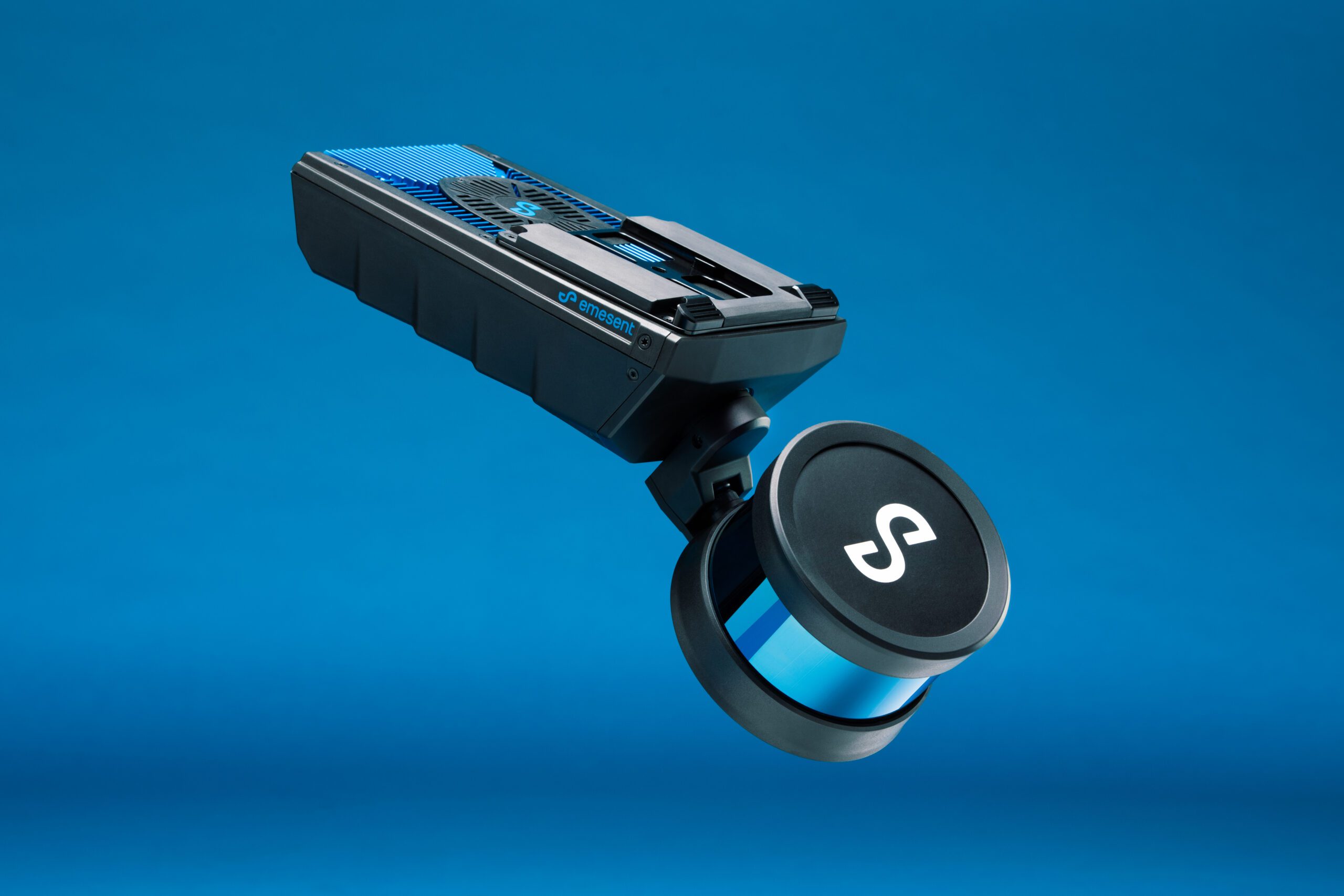
Mobile LiDAR scanning solution with survey-grade mapping
The Hovermap ST is setting a new standard in autonomous LiDAR scanning solutions by offering survey-grade mapping and georeferenced point clouds.
Contact us to learn more about the Hovermap ST.
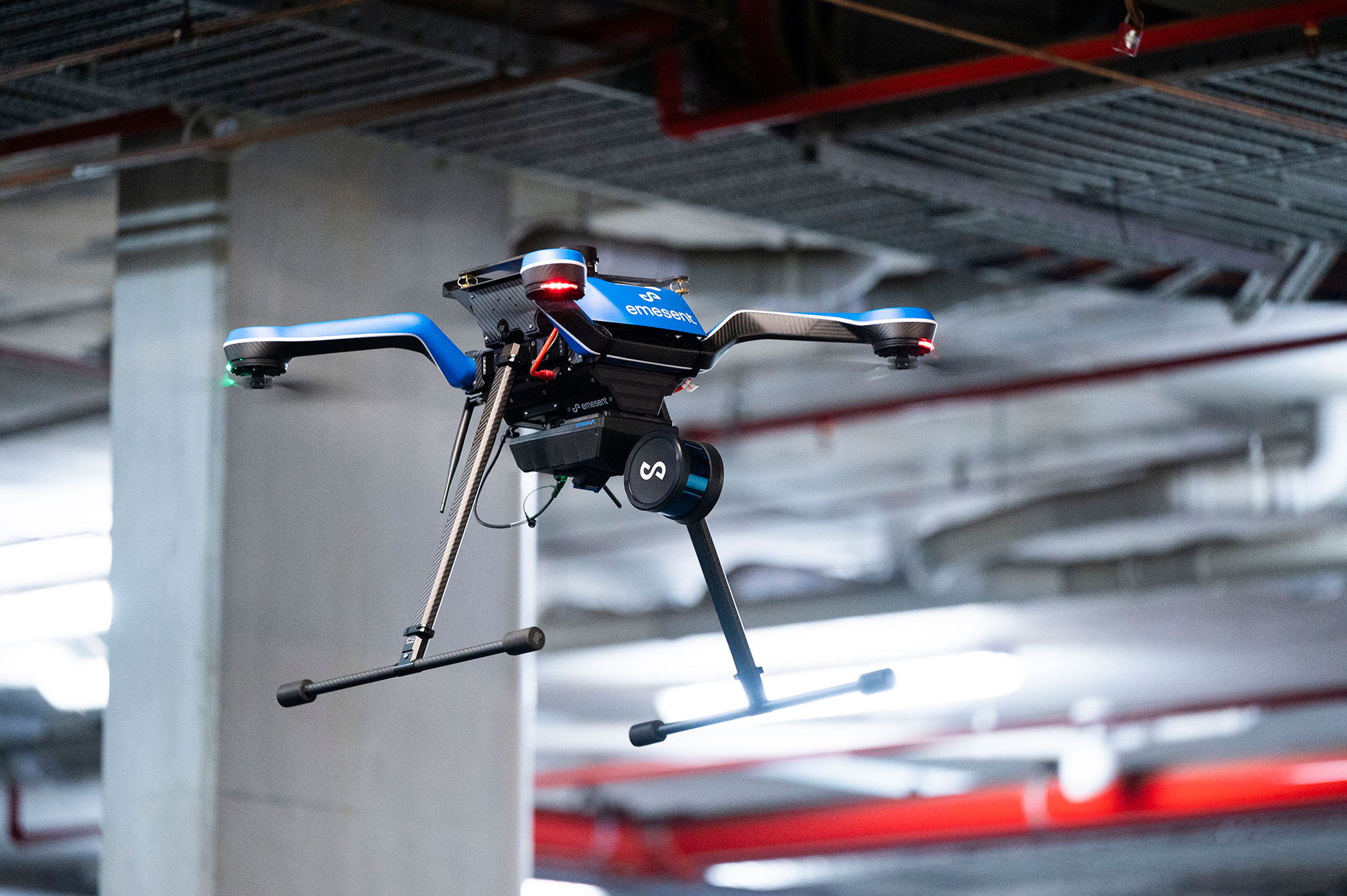
Navigate and map areas where no other drone has gone before
The tap-to-fly autonomy feature allows you to autonomously navigate inaccessible environments beyond the line of sight and communication range. In addition, the Hovermap ST utilizes the LiDAR data to actively provide collision avoidance, guided exploration, and smart return-to-home in underground environments where there is no GPS.
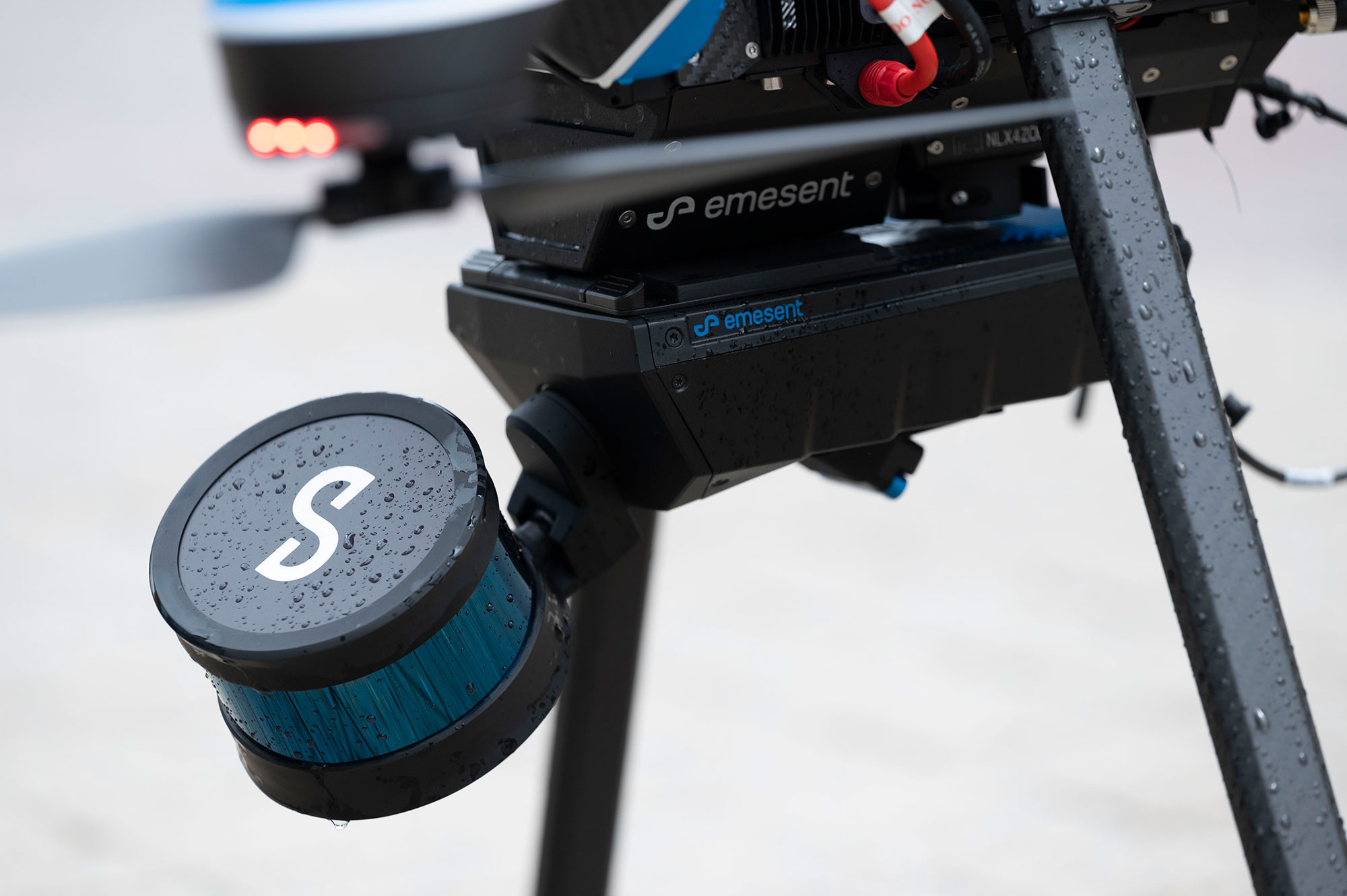
Tougher and lighter
The new IP65 weather-sealed design enables you to map and navigate even more challenging environments. Fly and scan longer than before with a compact and lightweight design.
Precision mapping
The Hovermap ST produces highly accurate LiDAR maps for engineering, surveys, or inspection applications powered by an industry-leading SLAM algorithm. In addition, the new automated ground control feature in the Emesent software makes it easier than ever to capture dense shadowless survey-grade point clouds. Place surveyed Emesent’s ground control targets in your scan area, and the software will automatically detect and apply a transformation to the point cloud.
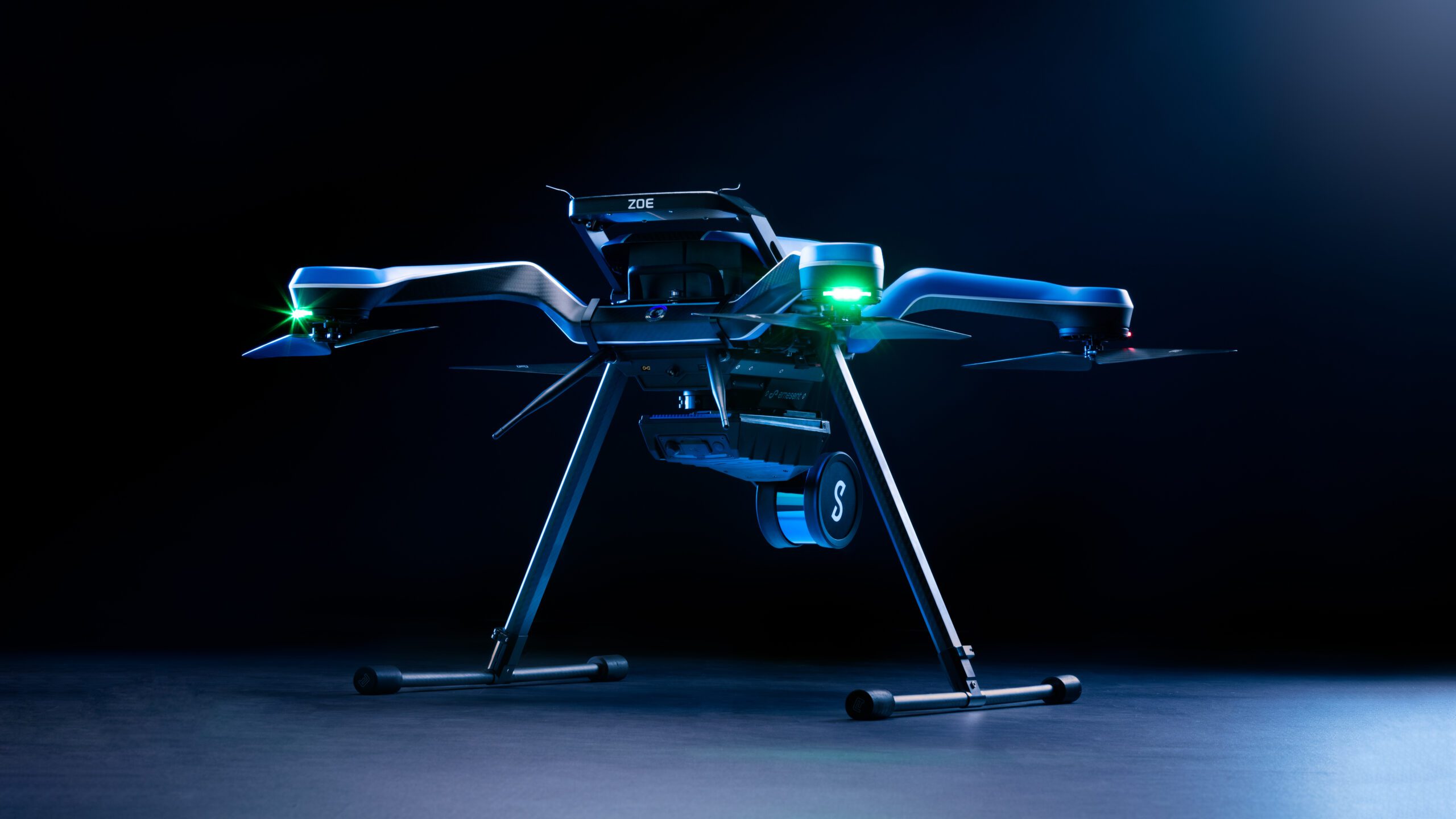
4-in-1 Versatility
Go from aerial scanning to mobile scanning in seconds.
- Drone enabled
- Vehicle mounted
- Backpack mounted
- Walking scans
Hovermap ST
Key System specifications
- Weight: 1.6 kg (3.63 lb)
- Supported drones: DJI M210v1, DJI M300, Acecore Zoe
- LiDAR range: 0.40m to 100m
- LiDAR accuracy: +/- 30 mm
- Mapping accuracies:
- ± 20 mm (3/4 in) in general environments
- ± 15 mm (19/32 in) in typical indoor and underground environments
- ± 5 mm (7/32 in) isolated change detection capability
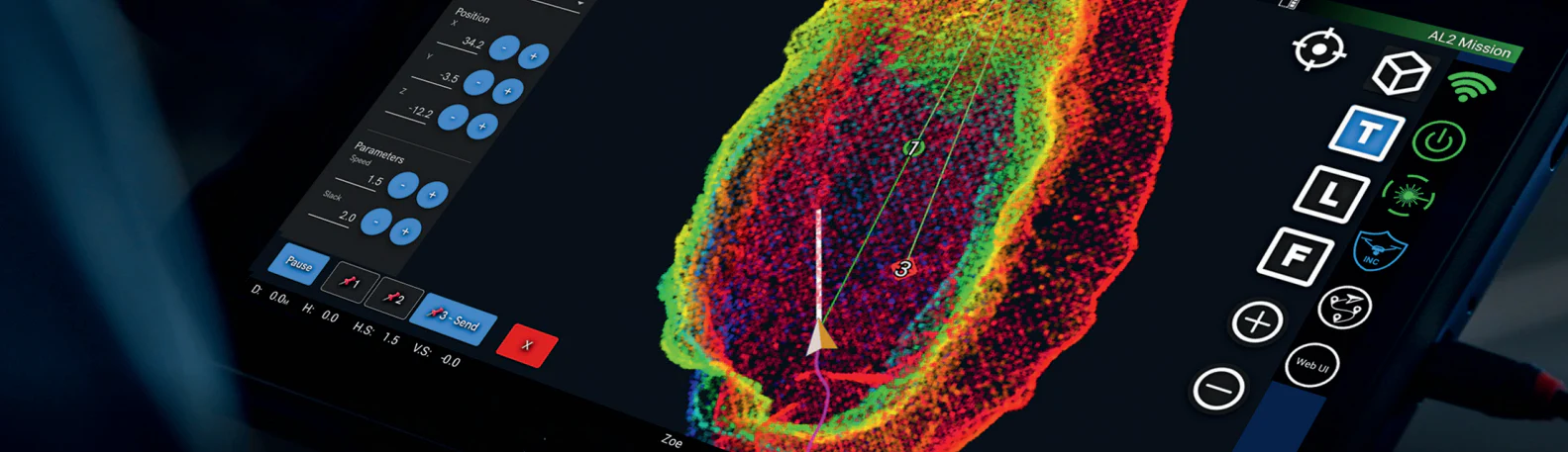
TWO LEVELS OF AUTONOMY ARE AVAILABLE AS ADD-ONS:
Autonomy level 1: Pilot assist mode
The Hovermap ST serves as an omnidirectional collision avoidance system that essentially creates a safety bubble around your drone in a GPS-denied environment—preventing collision with assets during a line-of-sight flight operation.
Autonomy level 2: Autonomous waypoints
Tap-to-fly enables beyond visual line-of-sight (BVLOS) navigation and mapping of inaccessible areas. This capability allows for autonomous navigation and mapping with a simple tap on the map generated by the Hovermap in real-time while protecting the system from a collision. For example, smart return-to-home capability typically requires GPS to navigate back; the Hovermap can return to home autonomously using the SLAM and LiDAR technology.
The best protection from wide-ranging threats
Visiontec is always adding innovative, new products. We offer the latest security and detection products that protect people, public and military facilities and infrastructure. Our consultants can also assist you in choosing the best detection solutions for your operations.
Visiontec Systems is an authorized Emesent Hovermap ST dealer. Contact us to learn more about the Hovermap ST.